App
Customer Support
Find Bookings


1 / 7


Mentioned in this post
5/520 reviews | Natural scenery
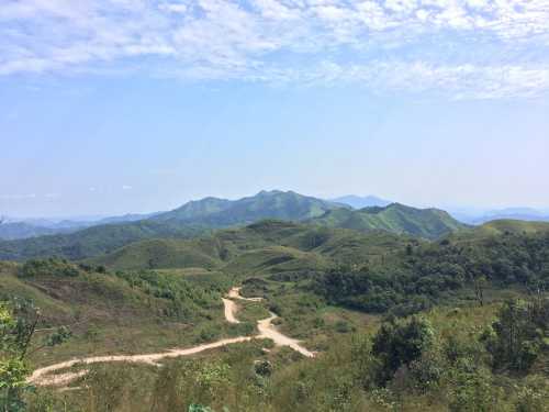
Thong Pha Phum
Details
Show more
Popular Trip Moments
Phu Phrai Tarn Nam Resort | Kanchanaburi | Jok Kradin Waterfall, Thong Pha Phum District, Kanchanaburi Province | Cherkow at Mongkala | Thong Pha Phum National Park, Kanchanaburi | Jok Kradin Waterfall, Thong Pha Phum National Park | Budget 2 thousand, travel to Ban E Tong, Pilok, Kanchanaburi | Phu Iyara Resort | Conquer 399 curves at Pilok E Tong 🛵💨 | Miner's shop, delicious snacks | Wat Ulong | Hot While Walking, Cold While Sleeping, But the View is the Reward | Viewpoint Km.12, Kanchanaburi Province | 🌧️ Traveling in the rainy season…conquering San Nok Wua ⛰️ | Baan E Tong, conquer 399 curves | Lam Khlong Ngu National Park | Kanchanaburi | Jokkradin Waterfall, Kanchanaburi | Ban E Tong-Pilok, a small village in Thong Pha Phum | Kawarin River Exclusive Hotel&Resort | Vajiralongkorn Dam, Thong Pha Phum | Cute cafe 109CAFE' | Jok Kradin Waterfall in Summer 🔅 | Kanchanaburi Riverside Raft | Conquer the mountain peak and pay homage to Phra Phuttha Chetiyakiree | Lam Khlong Ngu National Park | The Elephant Hill is truly as beautiful as a fairy tale. | Sleep in a house with fog in Ban Itong | 12 check-in points, Ban Itong | Rimbueng Kitchen | Jokkradin Waterfall
Recommended Attractions at Popular Destinations
Popular Attractions in Bangkok | Popular Attractions in Manila | Popular Attractions in Tokyo | Popular Attractions in Taipei | Popular Attractions in Hong Kong | Popular Attractions in Seoul | Popular Attractions in Kuala Lumpur | Popular Attractions in Los Angeles | Popular Attractions in Shanghai | Popular Attractions in New York | Popular Attractions in Shenzhen | Popular Attractions in Osaka | Popular Attractions in Singapore | Popular Attractions in London | Popular Attractions in Guangzhou | Popular Attractions in San Francisco | Popular Attractions in Beijing | Popular Attractions in Macau | Popular Attractions in Bali | Popular Attractions in Jakarta | Popular Attractions in Paris | Popular Attractions in Ho Chi Minh City | Popular Attractions in Istanbul | Popular Attractions in Phuket | Popular Attractions in Chicago | Popular Attractions in Seattle | Popular Attractions in Toronto | Popular Attractions in Orlando | Popular Attractions in Cebu | Popular Attractions in Chiang Mai
Popular Restaurants in Thong Pha Phum
Popular Ranked Lists
Popular Best Things to Do in Jishou | Popular Best Things to Do in Songpan | Top 50 Must-Visit Restaurants in New York | Top 10 Luxury Hotels near Sin el Fil | Top 50 Must-Visit Restaurants in Langkawi | Popular Best Things to Do in Ankang | Top 50 Must-Visit Restaurants in Munich | Top 10 Luxury Hotels near Pua | Top 50 Must-Visit Restaurants in Phuket | Popular Premium Hotels in Alghero | Popular Luxury Hotels Near Pitesti | Top 50 Must-Visit Restaurants in Sapporo | Top 50 Must-Visit Restaurants in Shanghai | Top 10 Premium Hotels near Ajibata | Popular Best Things to Do in Qinzhou | Top 20 Luxury Hotels near Madinet Al Bayadeyah | Top 50 Must-Visit Restaurants in Kuala Lumpur | Popular Luxury Hotels Near Prienai District Municipality | Popular Best Things to Do in Sheyang | Top 10 Luxury Hotels near Craiglie | Popular Best Things to Do in Nanping | Top 50 Must-Visit Restaurants in Auckland | Top 50 Luxury Hotels near Banbury | Popular Premium Hotels in Oakland | Top 50 Must-Visit Restaurants in Tokyo | Top 50 Must-Visit Restaurants in Barcelona | Popular Best Things to Do in Cangzhou | Popular Premium Hotels in Tehran Province | Popular Best Things to Do in Karamay | Popular Luxury Hotels Near Evros
About
Payment Methods
Our Partners
Copyright © 2025 Trip.com Travel Singapore Pte. Ltd. All rights reserved
Site Operator: Trip.com Travel Singapore Pte. Ltd.
Site Operator: Trip.com Travel Singapore Pte. Ltd.